Log In
Sign Up
My Cart
Donors
Oral History
ㅤ
Home
Browse
FAQS
Contact
Rights
Terrain
Total 2656
522 Photos
2134 Videos
Grid
Map
Timeline
The map only displays records that have geographic information. Switch to the
grid view
to see all records.
Map is loading...
Timeline is loading...
The timeline only displays records that have date information. Switch to the
grid view
to see all records.
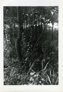
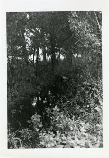
A view of swampy terrain, likely in New Orleans, Louisiana on 10 March 1942
A view of swampy terrain, likely at the Army Service of Supply Unit Training Center, New Orleans Staging Area,...
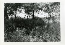
A view of swampy terrain, likely in New Orleans, Louisiana on 11 March 1942
A view of swampy terrain, likely at the Army Service of Supply Unit Training Center, New Orleans Staging Area,...
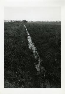
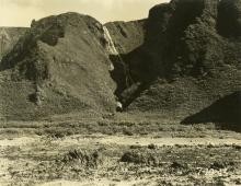
A view of swampy terrain, likely in New Orleans, Louisiana on 5 March 1942
A view of swampy terrain, likely at the Army Service of Supply Unit Training Center, New Orleans Staging Area,...
A view of swampy terrain, likely in New Orleans, Louisiana on 5 March 1942
A view of swampy terrain, likely at the Army Service of Supply Unit Training Center, New Orleans Staging Area,...
A view of swampy terrain, likely in New Orleans, Louisiana on 5 March 1942
A view of swampy terrain, likely at the Army Service of Supply Unit Training Center, New Orleans Staging Area,...
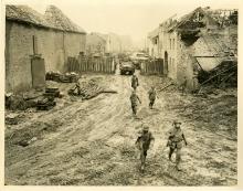
A view of the destroyed town of Echtz, Germany on 12 December 1944
A view of a destroyed town. Official caption: "ETO HQ 44 29329 12 Dec. Credit...U.S. Army Signal Corps. Photog--T/5...
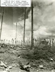
A view of the destruction that remained after the brutal fighting on Guadalcanal shows remains of a coconut grove where heavy fighting occurred in 1944
From Volume 1: South Pacific Theater. A view of the destruction that remained after the brutal fighting on Guadalcanal...
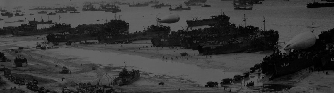
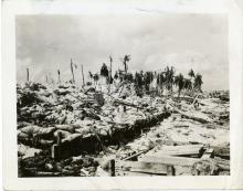
A war damaged landscape covered in military-related equipment and debris, Pacific Theater, 1943-45
Scene of war damaged landscape covered in military-related equipment and debris in the foreground and palm trees in the...
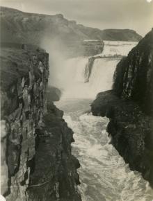
A waterfall in Iceland in 1943
"Esther Megill." A waterfall in Iceland in 1943
A waterfall in Iceland in 1943
"Iceland." A waterfall in Iceland in 1943
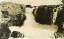
A waterfall in Iceland in 1943
"Iceland." A waterfall in Iceland in 1943
A waterfall in Iceland in 1943
A waterfall in Iceland in 1943.
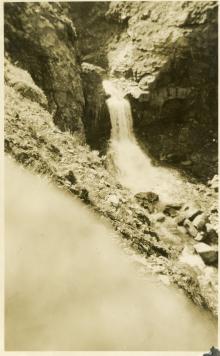
A waterfall in Iceland in 1943
"Iceland." A waterfall in Iceland in 1943
A waterfall in Iceland in 1943
"Iceland." A waterfall in Iceland in 1943
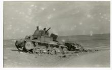
Abandoned Italian tank in North Africa (probably), 1942-43
Abandoned Italian Carro Armato M15/42 Medium Tank in a desert. There is another abandoned vehicle behind it. North...
Aerial photograph of the Ledo Road and pipelines cutting through farmlands in Burma in 1945
Photograph. Aerial photograph of the Ledo Road and pipelines cutting through farmlands in Burma in 1945.
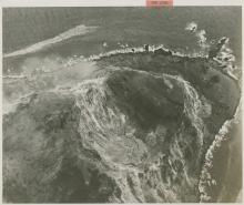
Aerial photograph of the muddy, crater-covered terrain of Okinawa, Japan, 1945
Photograph, aerial. View of the muddy, crater-covered terrain of Okinawa. Official Caption: "Rome, 7/16/45--Okinawa...
Aerial reconnaissance view of part of the Japanese stronghold on Kwajalein atoll as it looked on 30 January 1944
43.Photograph. Aerial view of Kwajalein before it was taken by US forces. 'File No. 213594 For Rotogravure Sections:...
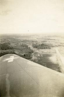
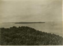
Aerial view looking out over an unknown Pacific location during World War II.
Aerial view looking out over an unknown Pacific location during World War II. Probably on New Guinea.
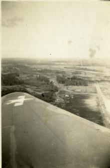
Aerial view looking out over an unknown Pacific location during World War II.
Aerial view looking out over an unknown Pacific location during World War II. Probably on New Guinea.
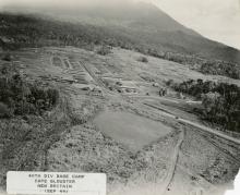
Aerial view of 40th Infantry Division base camp, Cape Gloucester, New Britain in September 1944
Aerial view of 40th Infantry Division"s camp on Cape Gloucester, including baseball field. "40th Div base camp, Cape...
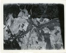
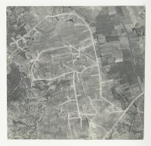
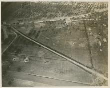
Aerial view of a European farming region
Photograph, aerial. Region of farming fields and wide roads. Location unknown. No date
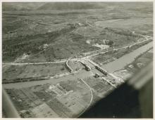
Aerial view of a river with three bridges, two of which are destroyed in Italy, circa 1944-1945.
148.Photograph. Aerial view of river and two bombed out bridges with a third intact. Italy. 1944-45
Aerial view of Casablanca Hospital, Morocco, 1943
Photograph, aerial. View of Casablanca Hospital tents and layout in from the air.Printed caption on photo front: "...
Aerial view of fortifications along the Gothic Line in the Apennine Mountains of Italy in November 1944
571.Photograph. '14 Nov 44. 5/MM-44-30313. Fifth Army, II Corps Area, Italy. Air view of fortifications in the Gothic...
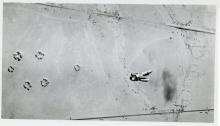
Aerial view of four bombs dropping towards desert terrain, North Africa (probably), 1942-43
Aerial view, from an airplane, that shows a group of four bombs falling towards a desert with two roads. There are six...
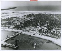
Aerial view of Kuraman Island and sea passage near Borneo, June 1945
Photograph, aerial.View of a tropical island (Kuraman Island) and sea passage. Notice the coconut palm trees on the...
Aerial view of Mount Suribachi on the southern tip of Iwo Jima on 20 February 1945
522.Photograph 'CinCPac-PCA AH-66 February 21, 1945 Closeup of Jap strong point on Iwo Jima This is a closeup view of...
Aerial view of railroad and several bomb craters in fields in Italy, circa 1944.
51.Photograph. Aerial view of railroad and several bomb craters in fields. probably 3131 Signal Service Co. Italy....
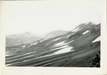
Aerial view of rugged hillsides and distant mountains covered with patches of snow. Umnak. 1944
Photograph, landscape. Aerial view of rugged hillsides and distant mountains covered with patches of snow. Umnak,...
Aerial view of Saipan, 1944
Slide. Aerial view of Saipan; clouds are partially obstructing the island. Saipan, Northern Mariana Islands. 1944
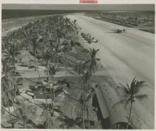
Aerial view of the Eniwetok Airstrip in August 1944
495.Photograph. Consolidated PB4Y-1 Liberators and Grumman F6F Hellcats on runway. 'File Number: 254811 August 8, 1944...
Airman standing at a cave entrance, Saipan, 1945
Slide. American airman standing in front of the entrance to a cave. Saipan, Northern Mariana Islands. 1945
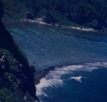
Airmen climbing down a cliffside, Saipan, 1945
Slide. American airmen climbing down a vegetation-covered cliffside; a beach is in the background. Saipan, Northern...
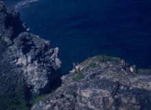
Airmen looking over a cliff, Saipan, 1945
Slide. Two small groups of American airmen looking of the edge of a cliff at the ocean below. Saipan, Northern Mariana...
Aleutian Islands landscape on 10 July 1943
Aleutian Islands/Alaskan landscape. "7-10-43."' 10 July 1943
Pages
« first
‹ previous
1
2
3
4
5
6
7
8
9
…
next ›
last »