
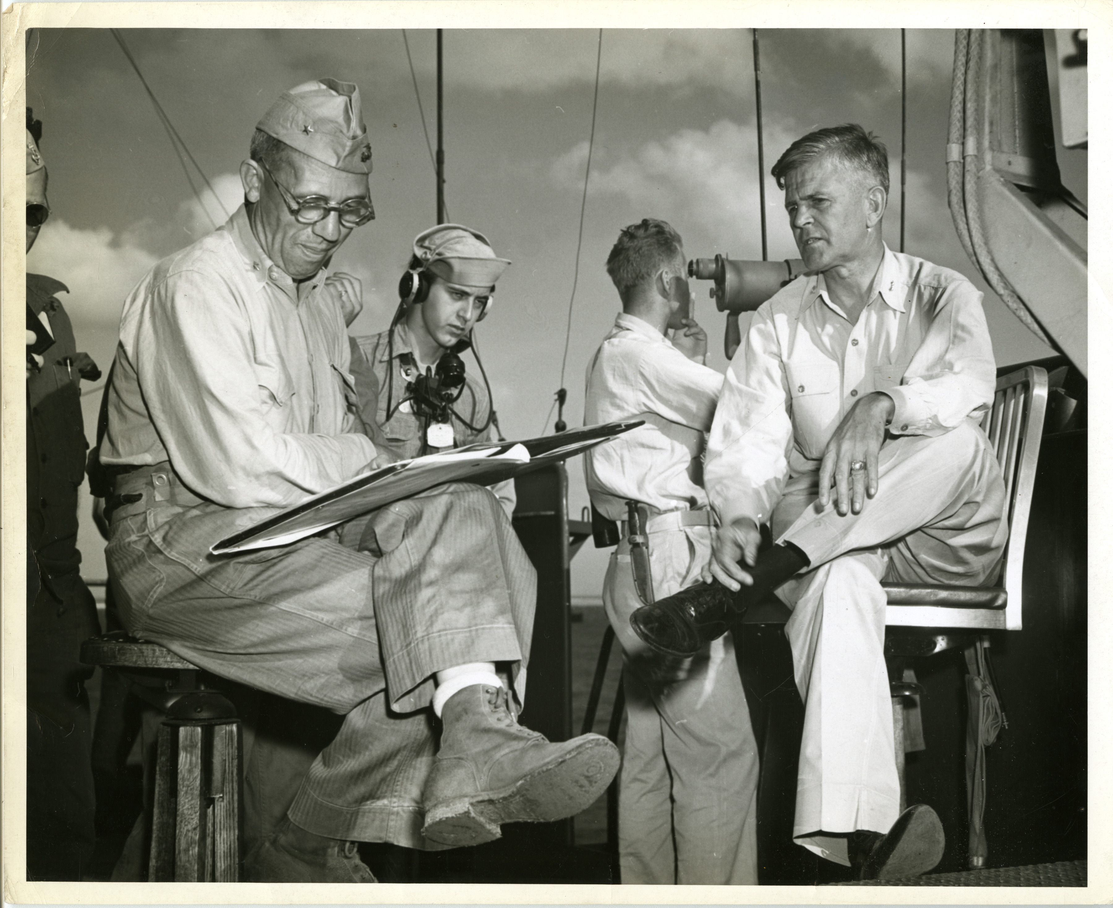
BGen Thomas Watson and Navy Rear Admiral Harry Hill mapping battle plans
Gift of the Scanlan Family
Description:
Photograph. Brigadier General Thomas Watson and Navy Rear Admiral Harry Hill mapping plans for the Battle of Enewetak. Official caption on reverse: "3353. From: Public Relations Division / U.S. Coast Guard / Washington, D.C. / Credit Line Must Read 'Official Coast Guard Photo.' Eniwetok Invasion Leaders Map Strategy. On the flying bridge of a Coast Guard-manned assault transport off Eniwetok Atoll, Marine Corps Brigadier General T.E. Watson (left) and Navy Rear Admiral Harry Hill pour over maps during the battle that smashed another Japanese stronghold in the Marshall Islands." Enewetak Atoll, Marshall Islands. February 1944
Image Information
Donor:
Accession Number:
Date:
1944-02-
Hometown:
Branch:
Theater of Service:
POW / KIA:
Topical Subjects:
Collection Level:
Items from the service of John J. Scanlan Jr., who served in the United States Coast Guard. Born in Quincy, Massachusetts, Scanlan worked for a newspaper prior to joining the Coast Guard. During the war, he acquired photographs published by the Public Relations Division of the United States Coast Guard. The collection consists of photographs from most of the theaters of operations and depict life in the field and aboard a ship for Coast Guardsmen and Marines. Also included is a satirical piece of military correspondence. See collection 2012.321 for more items from the collection subject.
Geography:
Enewetak
Latitude:
11.583
Longitude:
162.333
Thesaurus for Graphic Materials:
Military officers--American--Enewetak
Ships--American--Enewetak