
Map of Japan with U.S. occupation schedule, September 1945
Description:
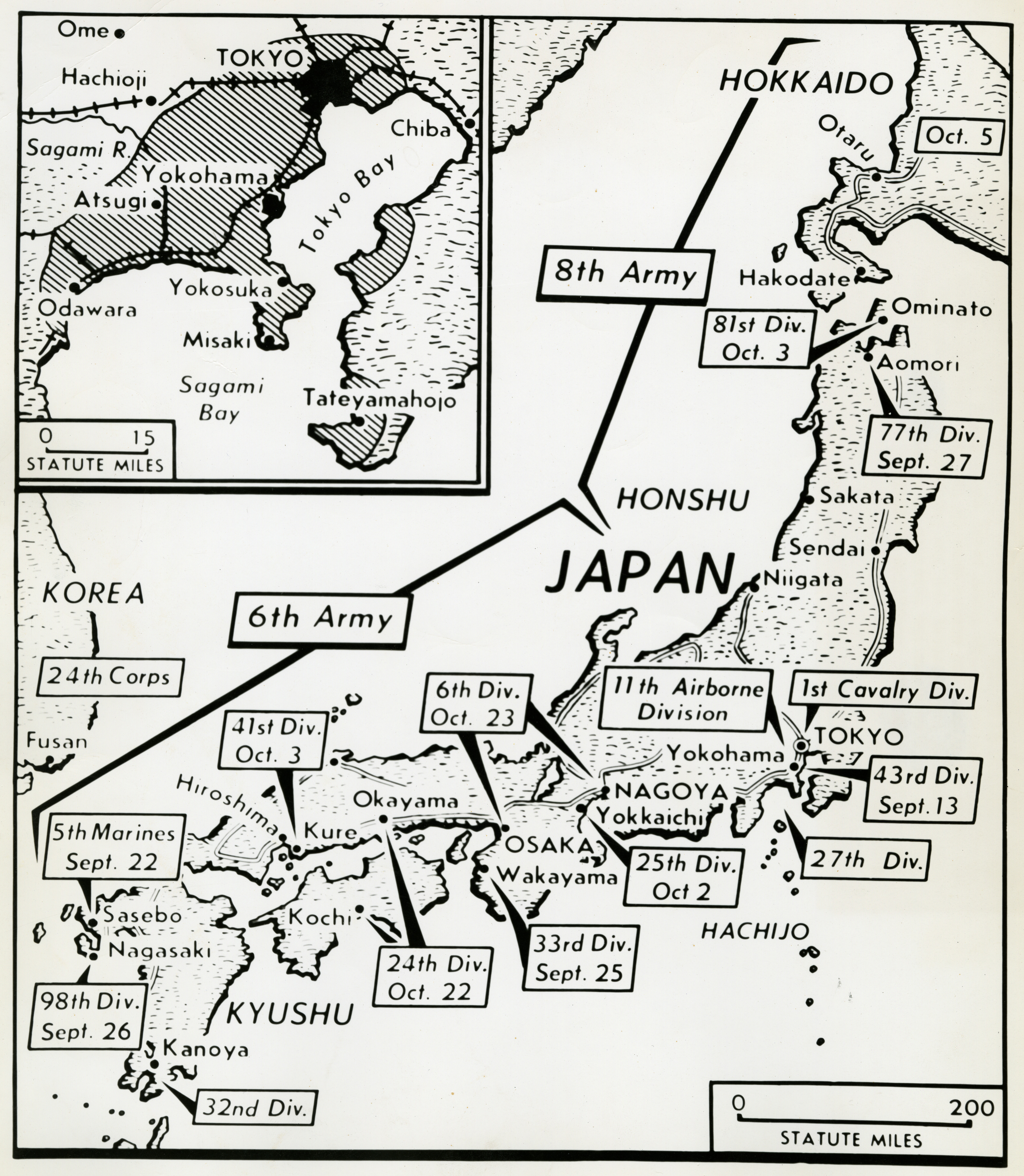
Photograph. Map showing location of occupation forces in Japan. Official Caption: "Sept. 24, 1945. MAP OF JAPAN WITH U.S. OCCUPATION SCHEDULE. This map of Japan shows the schedule of occupation of the enemy home island by U.S. forces, and the location of units already in Japan and Korea. The shaded area on the inset map indicates occupied territory in the Tokyo area, as of Sept. 11, 1945. PHOTO THROUGH HOME U.S.I.S. 43970--UN--PPA." Japan. 24 September 1945
Image Information
Donor:
Accession Number:
Date:
09/24/1945
Hometown:
Branch:
Theater of Service:
POW / KIA:
Topical Subjects:
Collection Level:
Items from the service of Isaac "Ike" Bethel Utley, who was born in Smith Mills, Kentucky on 3 March 1920. Ike enlisted in the Army Air Corps on 19 January 1942. He was shipped overseas to the European Theatre and worked with a supply division based out of the city of Naples with an office set up in a residential villa. Utley worked with the Office of War Information and used their photographs in news articles to inform soldiers of the progress of the war. At war's end, Utley returned stateside. A trunk full of over 800 photographs from the O.W.I. arrived on his doorstep from his office in Italy, sender unknown. This collection consists of those photographs.
Geography:
Nihon
Latitude:
36.000
Longitude:
138.000
Thesaurus for Graphic Materials:
Maps--Japan