
Photo reconnaissance map of bomb damaged areas in Yokohama, Japan, June 1945
Description:
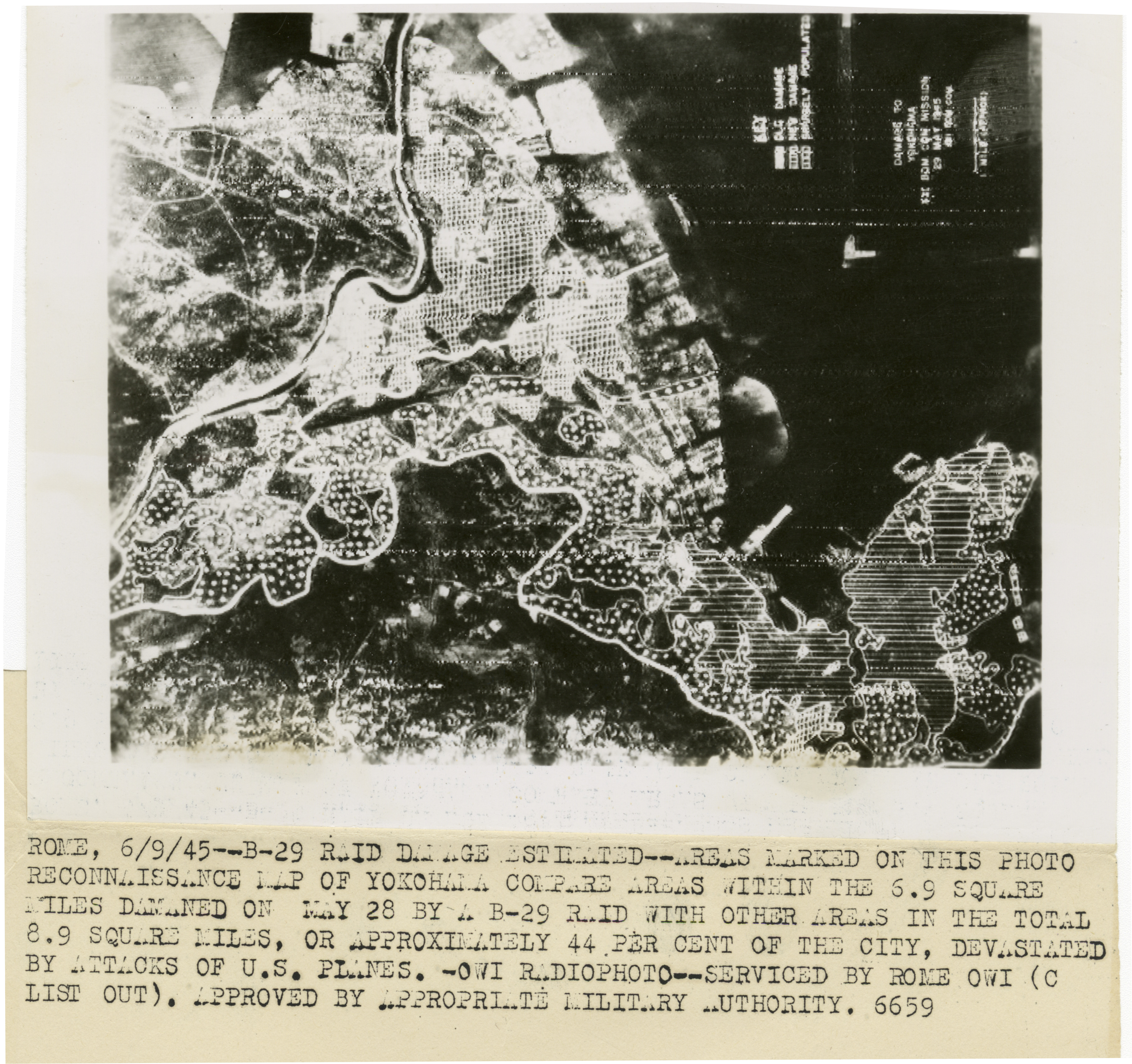
Photograph. Photo reconnaissance map of Yokohama highlighting damage inflicted by American B-29 bombers. Official Caption: "Rome, 6/9/45--B-29 raid damage estimated--Areas marked on this photo reconnaissance map of Yokohama compare areas within the 6.9 square miles damaged on May 28 by a B-29 raid with other areas in the total 8.9 square miles, or approximately 44 per cent of the city, devastated by attacks of U.S. planes.--OWI radiophoto--Serviced by Rome OWI (C list out). Approved by appropriate military authority. 6659." Yokohama, Japan. 9 June 1945
Image Information
Donor:
Accession Number:
Date:
06/09/1945
Hometown:
Branch:
Theater of Service:
POW / KIA:
Topical Subjects:
Collection Level:
Items from the service of Isaac "Ike" Bethel Utley, who was born in Smith Mills, Kentucky on 3 March 1920. Ike enlisted in the Army Air Corps on 19 January 1942. He was shipped overseas to the European Theatre and worked with a supply division based out of the city of Naples with an office set up in a residential villa. Utley worked with the Office of War Information and used their photographs in news articles to inform soldiers of the progress of the war. At war's end, Utley returned stateside. A trunk full of over 800 photographs from the O.W.I. arrived on his doorstep from his office in Italy, sender unknown. This collection consists of those photographs.
Geography:
Yokohama
Latitude:
35.467
Longitude:
139.633
Thesaurus for Graphic Materials:
Aerial photographs--Yokohama
War damage--Yokohama