
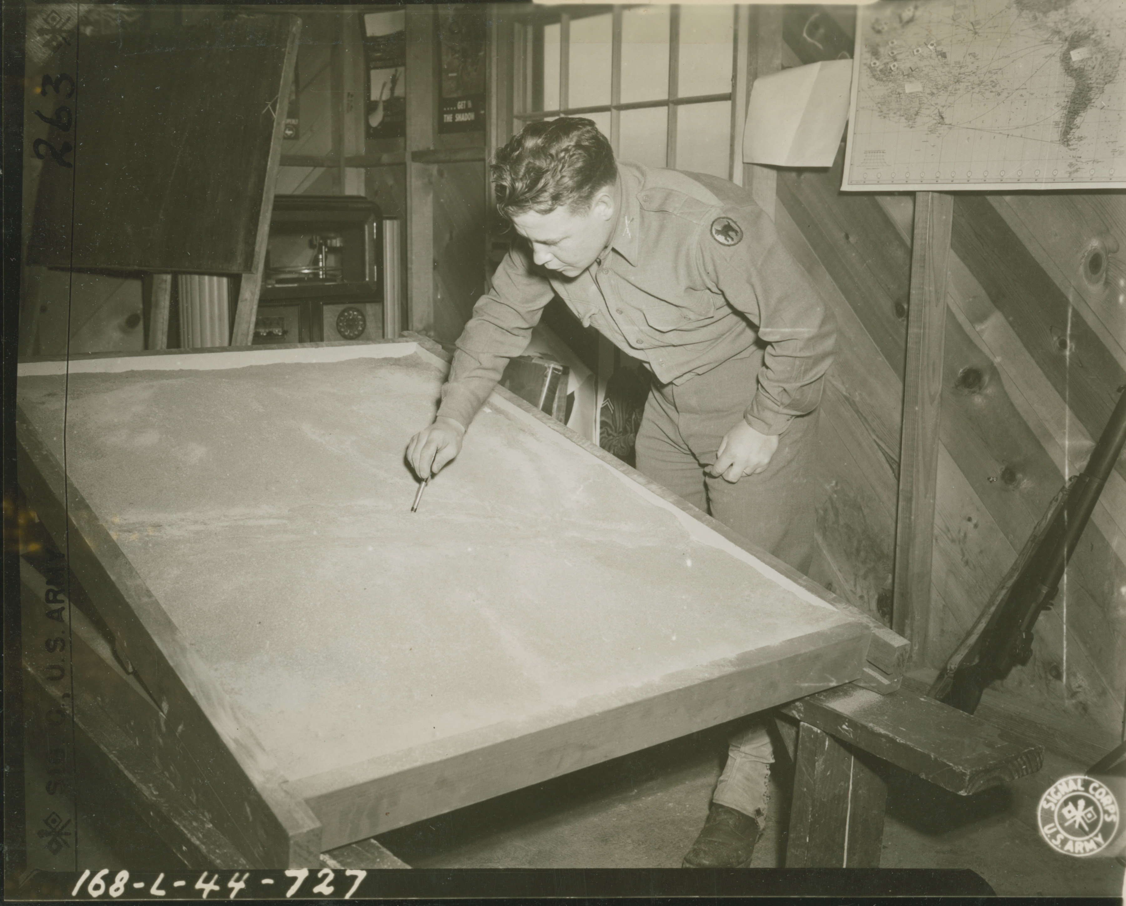
US servicemen creating topographic map for training exercises in California on 25 February 1944
U.S. Army Signal Corps photograph, Gift in Memory of Maurice T. White, from the Collection of The National World War II Museum
Description:
US servicemen drawing into sand to make topographic map for training exercises. "2-25-44. Barry. 2nd Lt. Robert Nicholson, of 'L' Co, 3rd Bn, 322nd Inf., is shown cutting a 'stream' into his sand table model, to be used in his class on scouting and patrolling. 168-L-44-727." Army Signal Corps photograph. Photographer: Barry. Probably Camp San Luis Obispo, California. 25 February 1944
Image Information
Donor:
Accession Number:
Date:
Hometown:
Branch:
Theater of Service:
POW / KIA:
Topical Subjects:
Collection Level:
From the collection of Maurice T. White, Captain in the 168th Signal Photographic Company, US Army Signal Corps. The collection consists of 2,000+ images of training exercises, predominantly documenting the 81st Infantry Division in the United States in 1944
Geography:
San Luis Obispo
Latitude:
35.267
Longitude:
-120.650
Thesaurus for Graphic Materials:
Topographic maps
Military training--California