Log In
Sign Up
Donors
Oral History
ㅤ
Home
Browse
FAQS
Contact
Rights
Search results
All
Photos
Videos
Narrow your search
Narrow your search
Branch of Service
US Navy (147)
Apply US Navy filter
US Marine Corps (27)
Apply US Marine Corps filter
US Army (15)
Apply US Army filter
US Army Air Forces (3)
Apply US Army Air Forces filter
Theater
Pacific Theater of Operations (PTO) (131)
Apply Pacific Theater of Operations (PTO) filter
European Theater of Operations (ETO) (47)
Apply European Theater of Operations (ETO) filter
Mediterranean Theater of Operations (MTO) (11)
Apply Mediterranean Theater of Operations (MTO) filter
Home Front (8)
Apply Home Front filter
Refine your search
Sort by:
Relevance
Date added
Grid
Map
The map only displays records that have geographic information. Switch to the
grid view
to see all records.
Map is loading...
French girl emerges from her hovel of twigs and branches in France in June 1944
472.Photograph. 'File No: 59431 June 15, 1944 Little French Girl Emerges from Her Hovel The shock of the lightning...
An Italian family struggles for existence on the outskirts of the battle lines near Anzio in March 1944
"File No: OOR-58430 March 4, 1944 Small Farm, Anzio As patient and hardworking as their beasts of burden, members of...
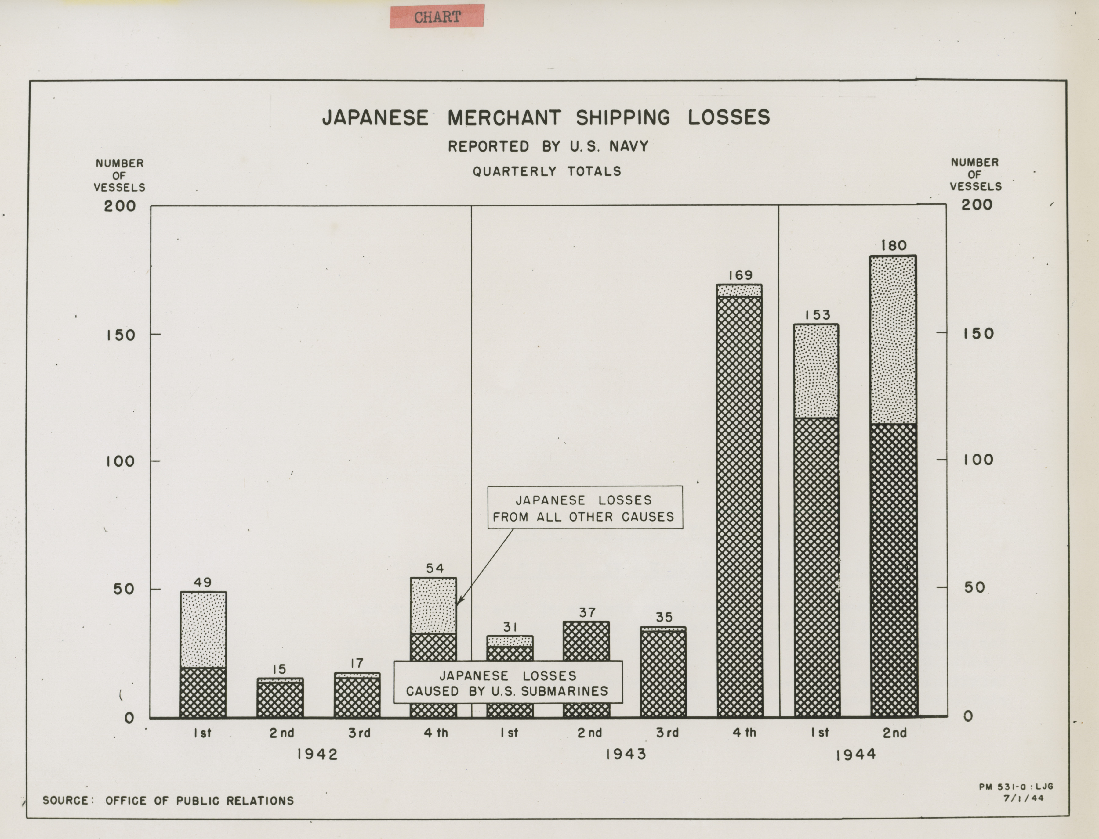
Japanese Merchant Shipping Losses Quarterly Totals 1942 1944 presented in July 1944
448.Photograph. Official U. S. Navy Chart 'File No: 45911 Japanese Merchant Shipping Losses Quarterly Totals 1942 1944...
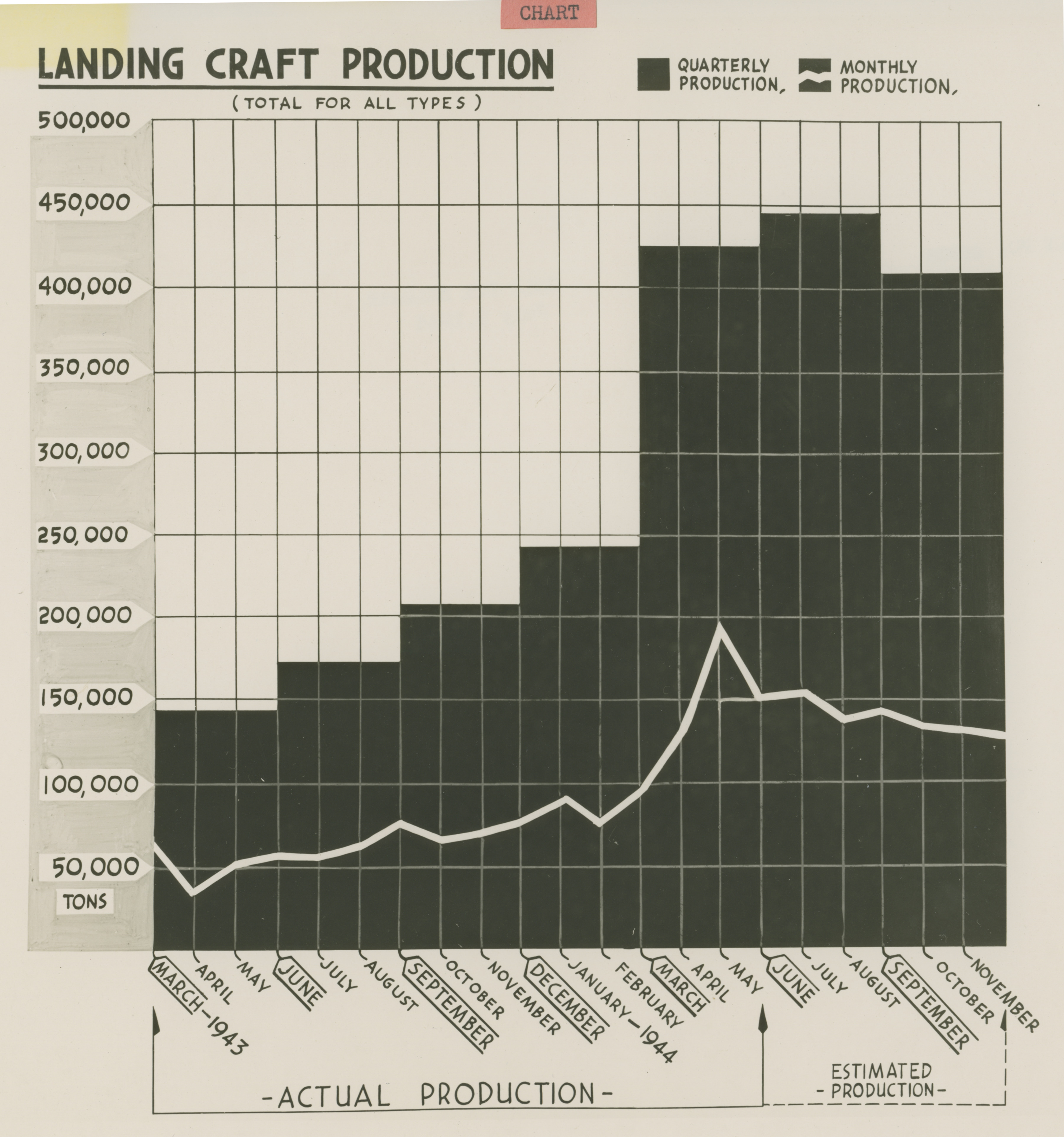
Landing Craft Production Quarterly and Monthly Production from March 1943 - November 1944 presented in 1944
449.Photograph. Official U. S. Navy Chart 'File No: 45908 July 9, 1944 Landing Craft Production Quarterly and Monthly...
Comparative proportion of warships authorized during the years from January 1, 1943, to January 1, 1944
439.Photograph. Official U. S. Navy Chart 'File No: 45292 April 23, 1944 Admiral King's Report: Plate II This plate...
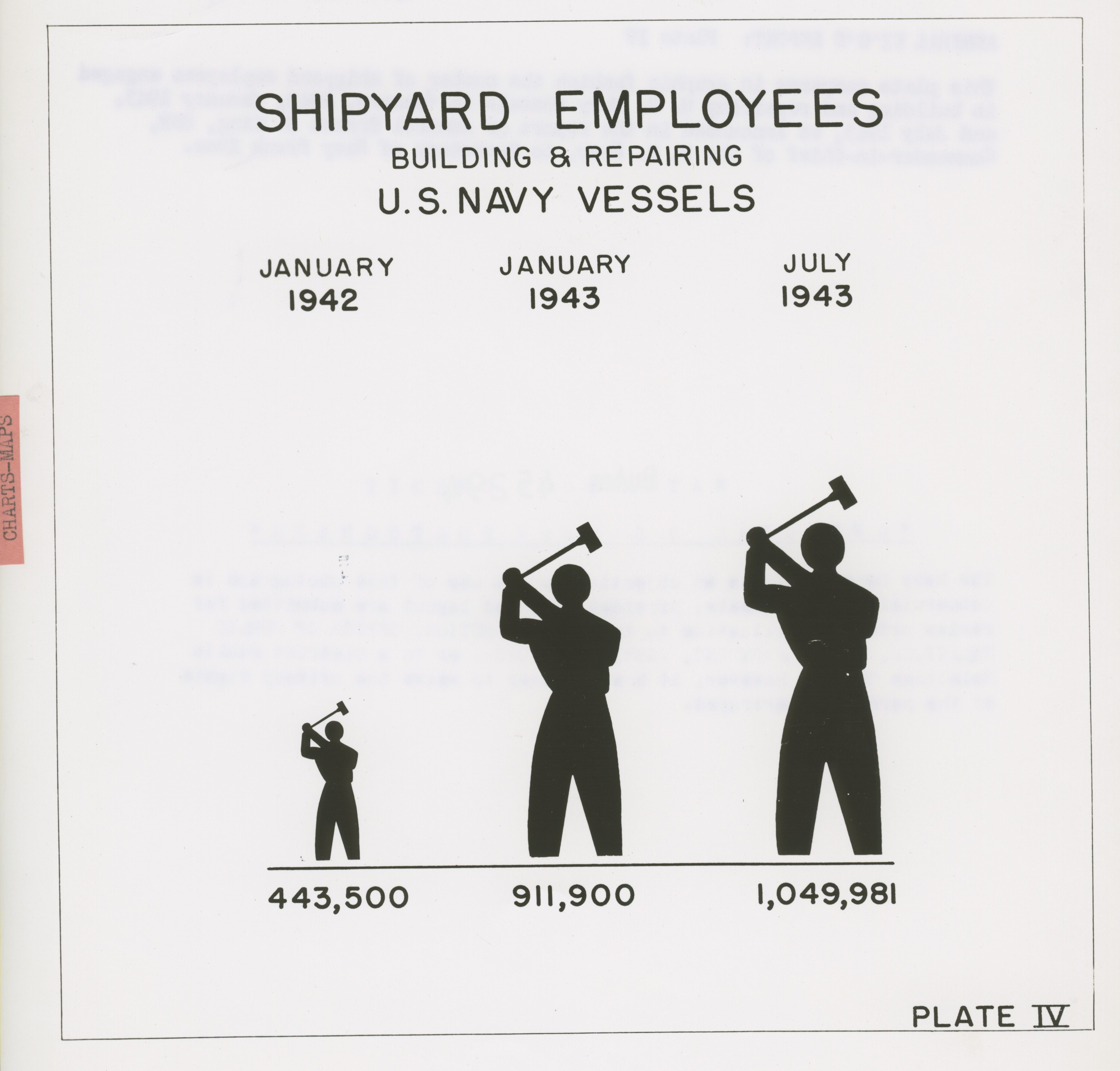
Number of shipyard employees engaged in building and repairing U.S. Navy vessels in January 1942, January 1943, and July 1943
441.Photograph. Official U. S. Navy Chart 'File No: 45294 April 23, 1944 Admiral King's Report: Plate IV This plate...
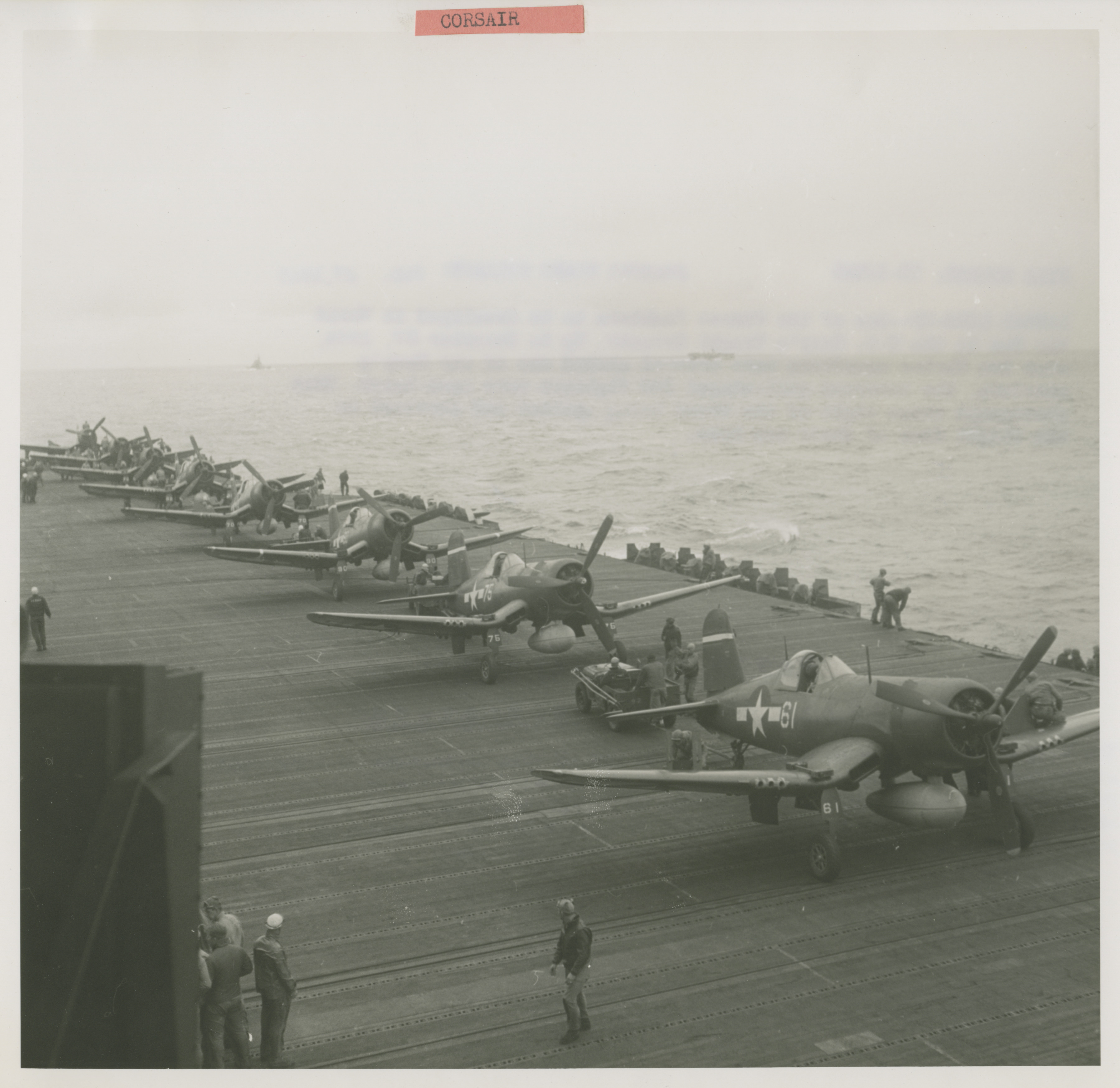
Eight U.S. Navy Vought Corsairs. being spotted and serviced on the flight deck of their new home in February 1945
451.Photograph. Chance Vought F4U Corsair ' File Number: TR-12926 Feb. 27, 1945 Lethal Line-Up One of the finest...
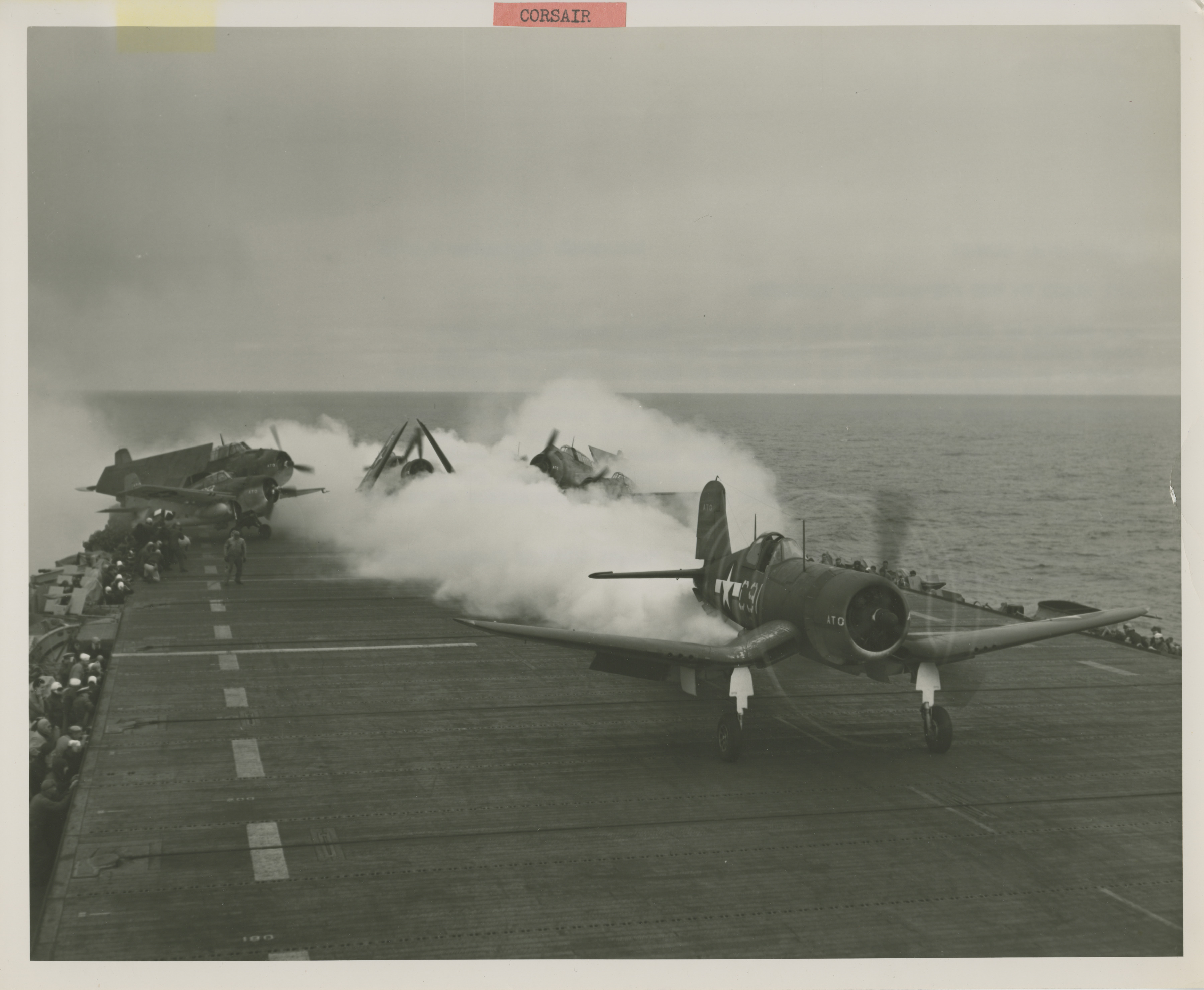
Doubly-powered by the flow of jet units, a Navy Vought Corsair fighter plane roars down the deck of a carrier for a takeoff in September 1944
450.Photograph. Chance Vought F4U Corsair. 'File Number: 215656 September 9, 1944 Navy Ready to Use Jet-Assisted...
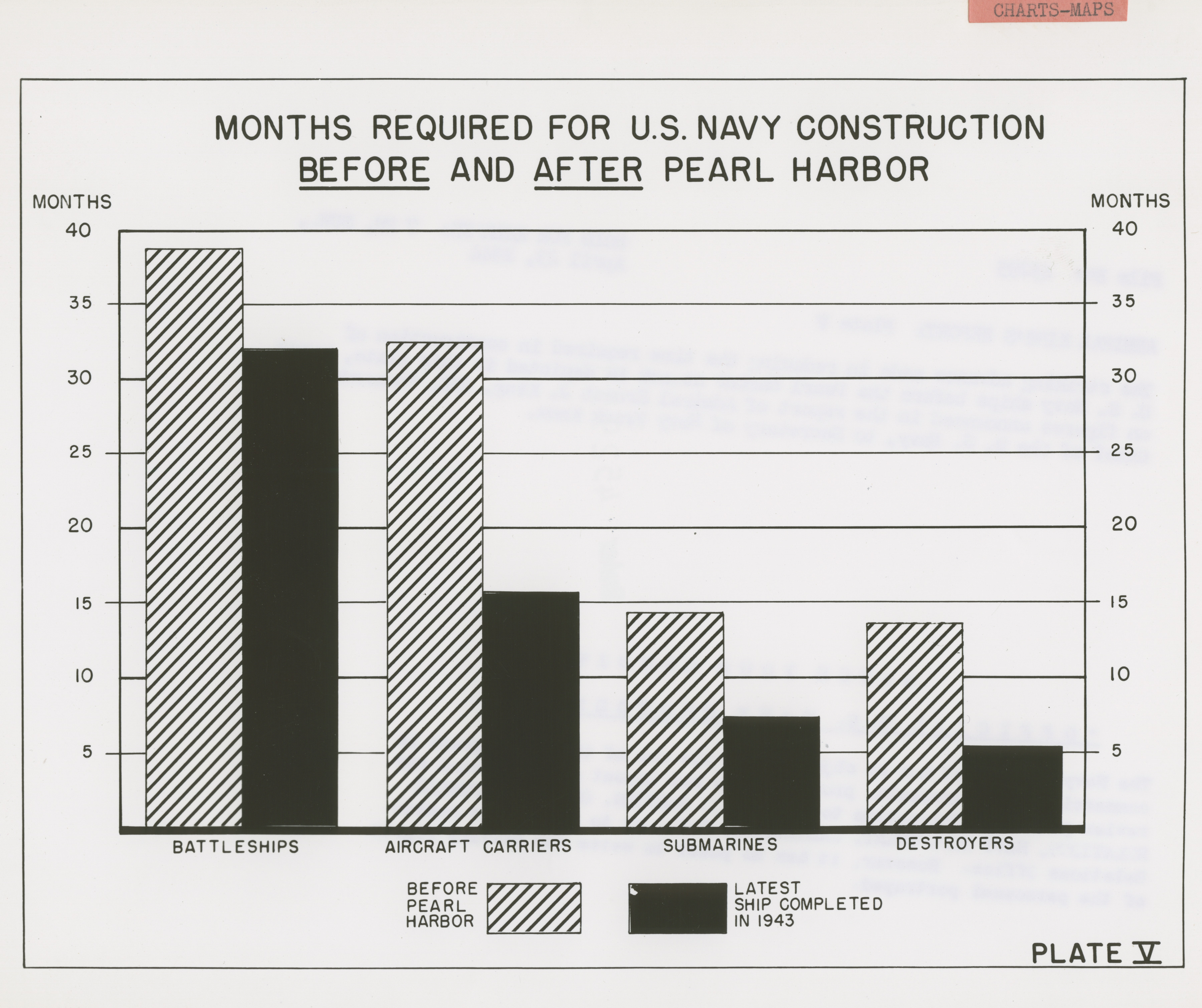
The advance made in reducing the time required in construction of U.S. Navy ships in April 1944
442.Photograph. Official U. S. Navy Chart 'File No: 45295 April 23, 1944 Admiral King's Report: Plate V The striking...
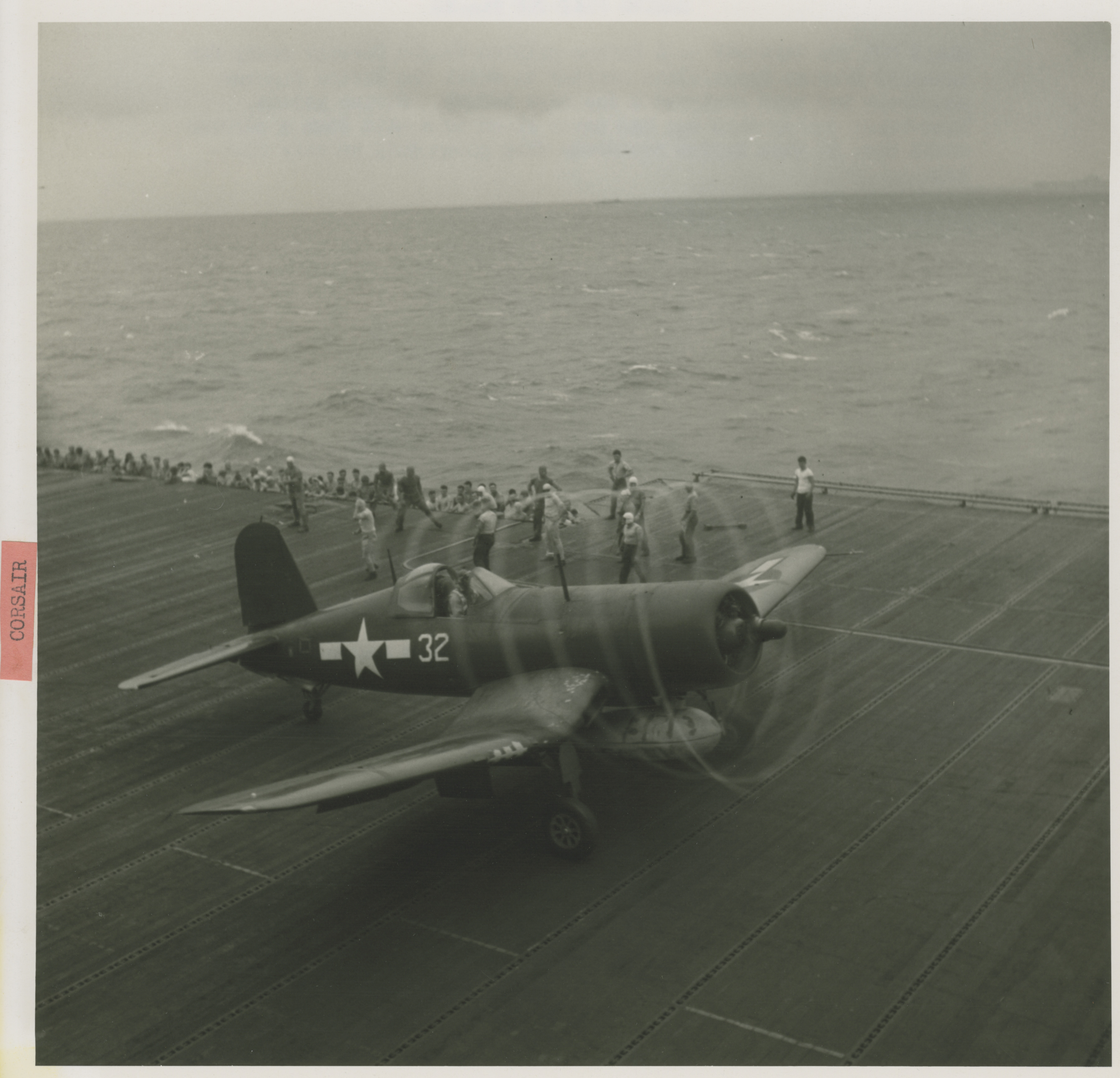
A Marine-piloted Corsair ready for take-off from an Essex class carrier to which two Marine fighter squadrons have been assigned in February 1945
452.Photograph. Chance Vought F4U Corsair ' File Number: TR-12682 Feb. 27, 1945 Marine Flat Top Flyers Ready for the...
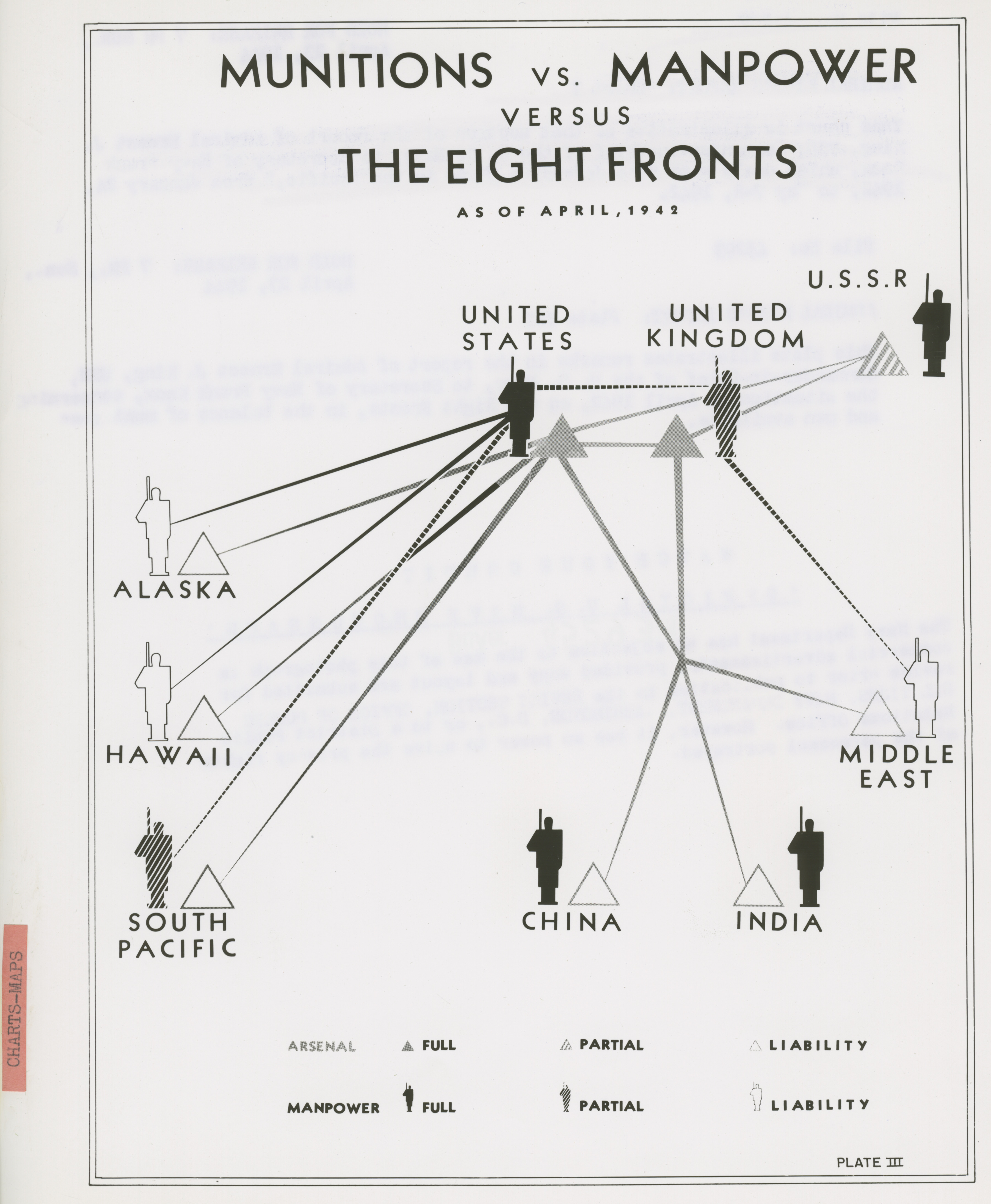
The situation in April 1942, on the Eight Fronts, in the balance of munitions and men available
440.Photograph. Official U. S. Navy Chart 'File No: 45293 April 23, 1944 Admiral King's Report: Plate III This plate...
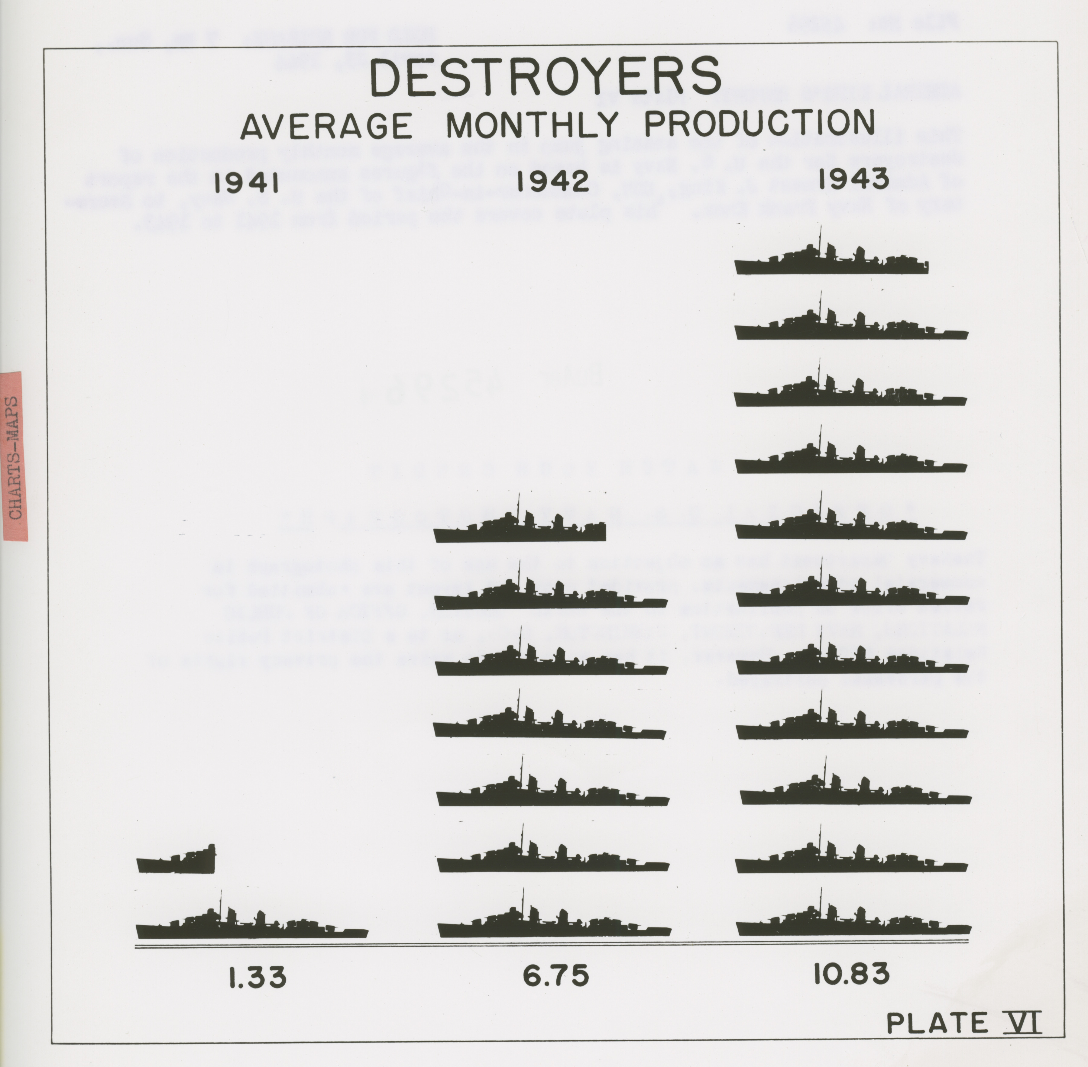
Jump in the average monthly production of destroyers for the U. S. Navy from 1941 to 1943 in April 1944
443.Photograph. Official U. S. Navy Chart 'File No: 45296 April 23, 1944 Admiral King's Report: Plate VI This...
Pages
« first
‹ previous
…
6
7
8
9
10
11
12
13
14
…
next ›
last »